Subdivision And Area Maps
The two images below are from the official Grand County Government website. To go to the site itself, which allows you to zoom in and access detailed information, click here.
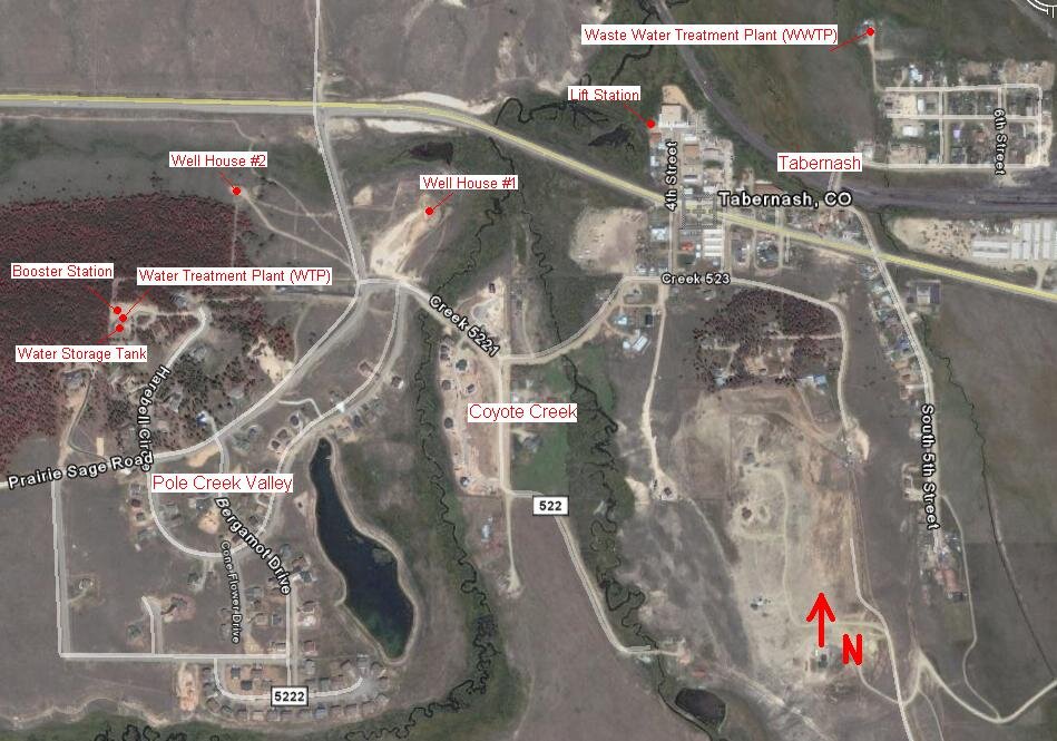
Tabernash Meadows Water and Sanitation District aerial view
This aerial photo gives you a great perspective of where our wells, water treatment plant, water storage plant and waste water treatment plant are located.
TMWSD District Boundary Map
Here’s a simple map showing the boundaries of our local water district.
Pole Creek Valley Plat Map
This three-page map is the official final plat for our subdivision.


